- LET'S PLAN YOUR SAFARI
- +256 200 921 002
- +256 793 194 703
- info@pickandtransfersafaris.com

Best time to Hike Mount Muhaura
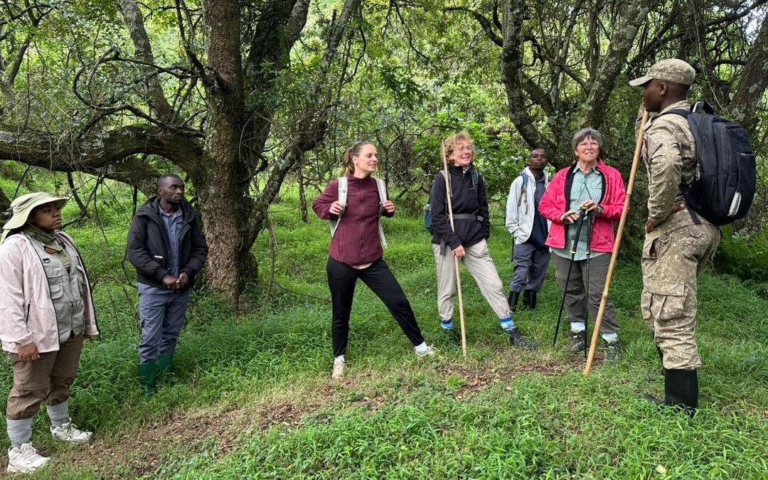
Best time to Hike Mount Muhaura. Rising sharply above the misty forests of southwestern Uganda, Mount Muhabura is one of the most rewarding volcano climbs in East Africa. At 4,127 meters above sea level, it is the third-highest of the eight Virunga Mountains and the tallest of the three volcanoes found inside Mgahinga Gorilla National Park. Its name comes from a local word meaning “the guide,” a fitting title for a peak that has long served as a landmark for travelers moving between Uganda, Rwanda, and the Democratic Republic of Congo.
If you are planning to add this volcano climb to your safari itinerary, timing your trip correctly can make the difference between a smooth, scenic hike and a muddy, exhausting slog. This guide breaks down exactly when to go, what conditions to expect, and how to prepare for one of Uganda’s most physically demanding but visually spectacular hikes.
Why Mount Muhabura Deserves a Spot on Your Uganda Itinerary
Mount Muhabura is widely regarded as the steepest and most challenging of the Virunga volcanoes accessible from Uganda. Unlike its neighbors Mount Gahinga and Mount Sabyinyo, which offer shorter and gentler ascents, Muhabura demands genuine stamina and a full day of effort. The reward, however, is considerable: a small crater lake at the summit, sweeping views across three countries, and on clear days, a glimpse of neighboring volcanoes including Sabyinyo, Gahinga, Karisimbi, Bisoke, and even distant Nyiragongo.
The hike takes climbers through several distinct vegetation zones, starting in bamboo forest, moving through heather belts, and finishing in high-altitude moorland. Along the way, hikers may encounter forest birds, small mammals, and the kind of silence that only comes from standing above the clouds. For travelers combining a volcano climb with gorilla trekking or golden monkey tracking, Muhabura adds a physically active, high-adrenaline component to an already unforgettable safari.
The Best Time to Hike Mount Muhabura
Mount Muhabura can technically be climbed year-round, but the best time to hike it is during Uganda’s two dry seasons: June to September and December to February. During these months, the park receives significantly less rainfall, keeping the trails firm, dry, and far more manageable underfoot.
Outside of these windows, particularly between March and May and again in October and November, the region experiences its heaviest rains. The volcanic soil on Muhabura’s slopes becomes slick and muddy, the heather zone turns slippery, and the steep sections near the summit become considerably more strenuous and riskier to navigate. Guides at the park still lead hikes during the wetter months, but pace slows, visibility drops due to afternoon fog, and the overall experience becomes noticeably tougher.
If your travel dates are flexible, aim for the heart of the dry season, particularly July, August, January, and early February, when rainfall is at its lowest and skies are clearest for those summit views.
Why the Dry Season Makes Such a Big Difference
The difference between hiking Muhabura in the dry season versus the rains is not a minor one. Firm trails allow for a steadier climbing pace, reduce the risk of slips on the steep, ash-covered slopes, and shorten the time it takes to reach the crater rim. Clear skies during the dry months also dramatically improve the chances of seeing the panoramic views the mountain is famous for, since cloud cover and mist frequently obscure the summit during the wet season.
Dry-season hiking also tends to be safer overall. The final approach to the top involves narrow ridgelines and loose volcanic rock, and dry conditions give hikers much more secure footing. Rangers and guides generally recommend the dry months for first-time climbers or anyone without extensive mountain trekking experience.
What to Expect During the Wetter Months
That said, hiking outside the dry season is not impossible, and some travelers actually prefer it. Trails are quieter, lodges around Kisoro often offer better rates, and the surrounding forest is lush and vibrant. If your safari dates only allow for a wet-season visit, it is still worth attempting the climb, just be prepared for muddy conditions, pack proper rain gear, and set realistic expectations about summit visibility.
Getting to Mount Muhabura
Mount Muhabura sits inside Mgahinga Gorilla National Park in Kisoro District, in Uganda’s far southwest. From Kampala or Entebbe, the drive takes roughly 9 to 10 hours by 4×4 vehicle, passing through Masaka, Mbarara, and Kabale. Many travelers prefer to combine the climb with a stay in the region, exploring Bwindi Impenetrable National Park along the way, or entering from Kigali, Rwanda, which is only about 3 to 4 hours away via the Cyanika border crossing.
For travelers already on a Rwanda safari, the mountain can also be climbed from the Kinigi side of Volcanoes National Park, since Muhabura straddles the border between the two countries. Both routes converge partway up the mountain, though the Uganda side via Ntebeko gate is the more commonly used trailhead for travelers based in Kisoro.
Permits, Fees, and Park Rules
Hiking Mount Muhabura requires a permit issued through the Uganda Wildlife Authority (UWA), the government body responsible for managing Mgahinga Gorilla National Park. Climbing fees are charged per person per day and typically fall in the range of 70 to 100 USD for foreign visitors, with lower rates for East African citizens. These fees include park entrance and a trained guide but usually exclude porter costs, which can be arranged locally at the park headquarters.
All hikes begin with an early-morning briefing at Ntebeko, where an experienced guide and armed park ranger are assigned to your group before departure. Booking permits in advance through a licensed tour operator is strongly recommended, especially during peak dry-season months when demand is higher.
If you are approaching from the Rwandan side, permits are instead handled through the Rwanda Development Board (RDB), which manages volcano hiking within Volcanoes National Park.
What to Pack for the Climb
Because Mount Muhabura involves a full day of steep hiking and significant elevation gain, proper preparation matters. Recommended essentials include:
- Sturdy, broken-in hiking boots with good ankle support
- A waterproof rain jacket, even during the dry season, since weather at altitude can shift quickly
- Layered clothing, since temperatures drop sharply near the summit
- Gardening or grip gloves for gripping vegetation on steep sections
- A walking stick or trekking pole
- Plenty of drinking water and energy-boosting snacks
- Sunscreen and a hat, since equatorial sun at altitude is intense even on cloudy days
- A basic first aid kit
- A camera with extra batteries to capture summit views
Fitness matters too. The climb typically takes between 6 and 10 hours round trip depending on pace, so cardiovascular preparation before your trip will make the day considerably more enjoyable.
Combining Mount Muhabura With Other Safari Experiences
Most travelers do not climb Muhabura in isolation. Mgahinga Gorilla National Park also offers gorilla trekking with the Nyakagezi family, golden monkey tracking, and cultural visits with the Batwa community. Because Muhabura is a full-day activity, many itineraries pair it with a rest day or a separate day dedicated to gorilla trekking.
If you are planning a broader Uganda or Rwanda trip, this region fits naturally into longer routes. Travelers heading north from Kisoro often continue toward Bwindi Impenetrable National Park for a second gorilla trekking opportunity, while those coming from Kigali frequently combine the climb with a Volcanoes National Park gorilla safari before crossing into Uganda. You can browse a full range of itineraries that include this region on our gorilla safaris and safari packages pages, or explore more of what southwestern Uganda and northern Rwanda have to offer on our destinations page.
Final Tips for a Successful Hike
Booking your climb during the dry season, June through September or December through February, remains the single most important decision for a comfortable, safer, and more scenic Mount Muhabura hike. Beyond timing, success on the mountain comes down to preparation: solid boots, layered clothing, enough water and snacks, and a realistic sense of your own fitness level.
Whether you are climbing for the physical challenge, the crater lake at the summit, or the rare chance to stand where Uganda, Rwanda, and the Democratic Republic of Congo meet, Mount Muhabura rewards those who plan around the weather. Pair it with gorilla trekking, golden monkey tracking, or a longer Uganda-Rwanda itinerary, and you have one of the most complete adventure experiences the Virunga region has to offer.
Ready to plan your Mount Muhabura climb? Get in touch with our team to build a custom Uganda or Rwanda itinerary around the best hiking season for your trip.